On Location
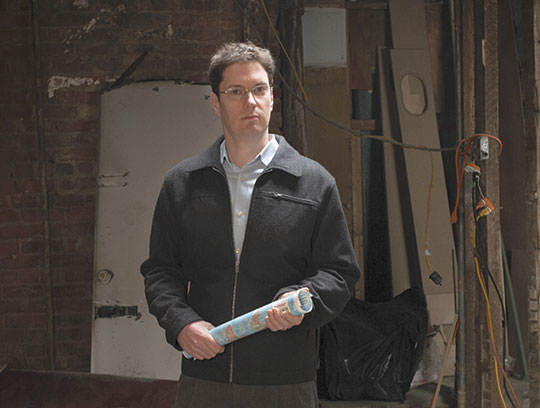
For disaster preparedness researcher Tom Chandler, geography is a key variable in the survival equation
For disaster preparedness researcher Tom Chandler, geography is a key variable in the survival equation
By Joe Levine
Among Tom Chandler’s heroes is the 19th century English physician John Snow, one of the fathers of the field of epidemiology. In 1854—nearly a decade before the advent of germ theory, when people still thought diseases were caused by a “miasma” of foul air—Snow traced a cholera outbreak in the city of Soho to specific contaminated water pumps.
“By using a map of the city’s pumps and looking at where people were dying, he figured out that it was awater-borne disease, not airborne,” says Chandler (Ph.D., ’09, M.A., ’00). “It really illustrates how a map can
solve problems.”
Solving problems with maps is Chandler’s own forte. As a research associate at the National Center for Disaster Preparedness (NCDP) at Columbia’s Mailman School of Public Health, he spends his days analyzing natural and human disasters—from Hurricane Katrina to last year’s earthquake in Haiti, to the recent catastrophic events in Japan that have resulted in partial nuclear meltdown—and the geographical factors that often help set them in motion or determine their ultimate outcome. Boyish looking, with glasses and unruly brown hair, Chandler projects the friendly politeness of an Eagle Scout—which can make it all the more jarring when he talks about running computer-simulations of 10-kiloton nuclear explosions in New York City. But there may be few people better equipped to think about forestalling or mitigating such horrific what-ifs.
“I’ve always been interested in how to take computer technologies and enhance the ways that information can be visualized,” he says. “Since 9/11, I’ve focused on how programs can highlight the specific needs of communities during disasters.”
The past five years have brought a quantum leap in such technologies—most notably Google Earth, which, through satellite and aerial photography, enables viewers to see details as small as specific streets and houses; and real-time geographic information, such as public health, weather and traffic data which, as the company itself puts it, “reveal relationships, patterns, and trends.” Google Earth, launched right before Hurricane Katrina, helped many survivors determine whether their homes were still standing.
A similar technology, deployed in Haiti immediately following the earthquake, pinpointed the largest concentrations of rubble, helping rescue workers make the most of the 72-hour period known as the maximum survival window.
Chandler, whose father was a photo engraver, studied these tools as a master’s degree student in TC’s Math, Science & Technology Department, and he teaches a course at the College on geospatial technologies. For light reading, he still absorbs books like The Visual Display of Quantitative Information, by the political scientist and statistician Edward Tufte. But he came to his present job via other interests, as well. While earning a second degree at the College in Social Studies and Education, he co-authored a chapter in TC’s nationally acclaimed “Teaching The Levees” curriculum, which explores civic issues raised by Hurricane Katrina and its aftermath. Titled “A Sense of Place, a Sense of Home: Using Geography to Understand the Levees Catastrophe,” the chapter takes as its starting point the comment made not long after Katrina by then-Speaker of the House Dennis Hastert that “it looks like a lot of that place could be bulldozed.” It poses the central question, “Given New Orleans’ geography and history of neglect of its infrastructure and natural resources, should the city be rebuilt? And if so, who gets to decide?” In one exercise, students are provided with an actual Army Corps of Engineers memo in which the Bush Administration is cited for insufficiently funding the completion of flood protection for New Orleans. In another, they grapple with whether American citizens can be accorded refugee status in their own country.
Such questions shape Chandler’s current work. Like his boss, NCDP founding Director Irwin Redlener, Chandler is particularly concerned with protecting the most vulnerable populations—children, the very poor and the elderly —who often face increased risk simply by virtue of where they live. New Orleans’ Ninth Ward, home to the city’s poorest citizens, is also in the most low-lying area, making it a prime target for flooding. In Haiti, the shanty towns—densely packed with loosely constructed, makeshift structures—were a death trap waiting to happen. And a cholera outbreak occurred after the earthquake primarily because most of the nation’s population lack access to any kind of health care services (and also, it seems, because of a new strain of the disease unwittingly brought in by foreign relief workers).
Yet for all the deaths and damage wrought by violent disasters, Chandler believes that infectious disease—arising in the wake of these events or as epidemics triggered by other factors—may pose the greatest threat.
“The world has seen an enormous population increase over a very short period—there will be nine billion people on the planet by 2050,” he says. “More and more people are migrating from the developing to the developed world, and vice versa, which is accelerating the spread of microbes. There’s increased urbanization into previously rural areas. And there are growing concerns about climate change and how that will impact the breeding patterns of various types of rodents and insects that carry disease.”
Again, societal inequities increase the threat to the most vulnerable populations at risk—but they threaten everyone else, too.
“When any segment of the population goes untreated, everyone is endangered,” Chandler says. “During the H1N1 outbreak in the United States two years ago, many undocumented workers were afraid to go to health care facilities because they were worried about being turned in and deported. But viruses don’t care about borders and citizenship papers. They’re just looking for a new host.”
When they find one, the reach can extend far beyond the impact of a quake or a tsunami, and the after-shocks can go on for far longer. One of the worst disasters of the 20th century, for example, was the 1918 flu pandemic, which killed approximately 40 million people worldwide at a time when air travel was only in its infancy.
“A lot of research suggests that a new strain of influenza could happen soon,” Chandler says, “so we’ve got to think about the ramifications.” Again, issues of social vulnerability would be front and center. “How many people would have access to respirators, or to Tamiflu and other medicines? Would health insurance be needed to get those things, and how many people would have it?”
Thinking about these things is scary—but not thinking about them, in Chandler’s view, is a lot scarier. As bad as the recent disaster in Japan has been, it would likely have been far worse if Japan wasn’t a world leader in preparedness, with an earthquake early warning system, a K–12 curriculum that includes tsunami evacuation procedures and a clearly established incident command system with procedures for debris removal, provision of shelter and other critical needs. By contrast, Chandler says, U.S. readiness and capabilities are pretty much still where they were during Hurricane Katrina.
“An effective response involves extensive planning, investment in preparedness, coordinated leadership, integration with the private sector and volunteer organizations,” he says. “The U.S. has a long way to go in all those areas, and in the current economic climate, states are cutting their budgets for these kinds of efforts.”
NCDP, for its part, is trying to jump-start the conversation by looking at the potential impact of issues such as climate change. “We talk to the insurance industry, which is further along in its thinking than many county and state governments,” Chandler says. “They’ve helped us amass geographic data on the hot zones for different types of risk, and the urban areas that are most susceptible to sea-level rise—Houston, Miami, New York City.”
Individuals need to think about such dangers as much as the government does, Chandler says—but there, too, the picture is not encouraging.
“There’s not always a sense of self-reliance. Studies we’ve done show that, regardless of the type of disaster, Americans have the expectation that an ambulance will come within a three-day period, but in a lot of these major disasters, it may not come for three weeks or at all. There’s not a realization that resources are limited. People need to develop emergency plans about where to meet, and they need to have enough food, water and medicines ready for at least three days.”
Ultimately, education is the key—and to that end, NCDP, with Teachers College as a partner, recently received federal funding to act as one of 14 university-based regional disaster planning centers nationwide. The College’s EdLab, a unit within the Gottesman Libraries, is developing preparedness training materials for public health workers, and, in an actual disaster, would provide a facility to create messaging to the public.
It’s a scary world, but Chandler sees plenty of reasons for hope, too. During 9/11 and again during the blackout a few years later, New Yorkers demonstrated resilience and courage. Average citizens mounted boat rescue efforts in New York Harbor, directed traffic and generally rose to the occasion.
“I’ll take my chances here,” he says.
For information about personal disaster preparedness, see a brochure developed by NCDP and the Children’s Health Fund at http://bit.ly/eZ7t0o. NCDP also developed a “Preparedness Wizard,” accessible at http://bit.ly/eFTDux, for a customized plan.
Published Friday, May. 20, 2011